Last updated: June 2026

Of all the things that define Nanyuki, none is more iconic than its position on the equator. The town sits almost exactly on the line of zero degrees latitude, and the famous equator crossing on its edge — with its big yellow sign and entertaining water demonstration — is one of Kenya’s most-photographed roadside attractions and an essential Nanyuki experience. This guide covers visiting the equator in Nanyuki from the town’s perspective: where it is, what to expect, the science (and showmanship) behind the demonstration, how it shapes Nanyuki’s identity and climate, and how to fold it into your time in town.
It takes only twenty minutes, but it’s a quintessential Nanyuki moment — here’s how to make the most of it. For the broader visitor experience, see also our dedicated equator line guide.
Where the Equator Crosses Nanyuki
The equator marker sits right on the main Nanyuki–Nairobi highway, just a few kilometres from the centre of town, announced by a large yellow signboard reading “This sign is on the Equator.” You can’t miss it — it’s directly on the route most visitors take in and out of Laikipia, with space to pull over. Its position on the edge of Nanyuki means it’s woven into the fabric of the town: Nanyuki is, first and foremost, “the equator town,” and the line is part of its identity and its appeal. Whether you stop deliberately or pass it en route to a day trip, it’s an unmissable part of the Nanyuki experience.
The Water Demonstration
The main event at the equator is the famous water demonstration, performed by the local guides who station themselves at the marker. They pour water into a basin or funnel placed directly on the line, drop in a flower or matchstick to reveal the motion, and let it drain — barely rotating on the line itself. Then they move a few metres north, and the water swirls clockwise; a few metres south, and it swirls anticlockwise. It’s presented as the Coriolis effect, and it’s genuinely entertaining and memorable, even though (as we explain below) the real physics is more subtle. The guides are skilled showmen, and the demonstration is a beloved part of the Nanyuki equator experience that delights visitors of all ages.

The Science Behind It
Since everyone wonders: the Coriolis effect is real and important — because the Earth rotates, large-scale moving air and water deflect (right in the Northern Hemisphere, left in the Southern), shaping weather systems and ocean currents. However, at the tiny scale of a basin of water, the genuine Coriolis force is far too weak to control which way the water drains; the swirl you see a few metres apart is created by the guide’s pour and tilt, not the planet. This doesn’t spoil the fun at all — think of it as a brilliant piece of theatre built around a real scientific truth, and a far more memorable physics lesson than any classroom. Knowing the honest science makes the demonstration more interesting, not less, and is a nice thing to explain to curious children.
What Else to Expect
Around the marker you’ll find a cluster of curio stalls and local artisans selling crafts, carvings, beadwork and souvenirs — a decent spot for gift shopping (see our shopping guide and bargain politely). For a small, negotiable fee, the guides will issue a printed certificate confirming you crossed the equator at Nanyuki, complete with the latitude — a fun keepsake, especially for children and first-timers. It’s customary to tip the guide who performs the demonstration; a small note is plenty and supports the local families who run the stop. There’s no formal entry fee to stand at the marker itself. Take the obligatory photo astride the line, with a foot in each hemisphere and the yellow sign behind you.
The Equator and Nanyuki’s Identity
The equator is more than a roadside stop — it’s central to Nanyuki’s identity and even its climate. The town’s position on the line, combined with its altitude of nearly 2,000 metres, gives it the famously temperate, spring-like weather that made it attractive to settlers and remains one of its charms today (more in our Nanyuki weather guide). Nanyuki markets itself as the equator town, and the line draws a steady stream of visitors who might otherwise pass straight through. It’s a point of local pride and a genuine geographical curiosity: standing on the equator, in the shadow of Mount Kenya, in a town that exists in large part because of its position on the map, is a quietly special thing — and a good lens through which to appreciate Nanyuki’s history and character.
Combining the Equator with Your Day
Because the equator stop takes only twenty minutes, it’s best combined with other Nanyuki experiences rather than treated as a destination in itself. With Mount Kenya rising behind the town, you can pair it with a mountain viewpoint or foothills hike. Ol Pejeta and the chimpanzee sanctuary are half an hour away, and the cool pools of Ngare Ndare Forest within reach. A natural plan is breakfast in town, the equator mid-morning (while Mount Kenya is clear behind it for photos), then a conservancy or forest excursion. See our day trips guide for how to build the perfect Nanyuki day around this iconic stop.
Best Time to Visit the Equator
The equator marker is accessible every day, year-round, and being a quick roadside stop it’s never weather-dependent the way a game drive is. That said, mornings are best: the light is softer for photographs, and on a clear day Mount Kenya rises majestically behind the scene before the cloud builds. The dry seasons bring the clearest mountain backdrops. Since you’ll likely be passing through Nanyuki anyway, simply time your visit for a clear morning and you’ll catch the equator at its photogenic best. Avoid the harsh midday for the best photos. It’s a flexible, easy stop that fits around the rest of your Nanyuki plans whenever suits.
Photographing the Equator
The equator is one of Nanyuki’s most photogenic stops, and a few tips help you get the shot. The classic image is standing astride the yellow sign with a foot in each hemisphere, so frame the sign clearly in the background. Mornings are best: the light is softer, and on a clear day Mount Kenya rises majestically behind the scene before cloud builds over the peaks, giving a spectacular backdrop. Get low or step back to capture both the sign and the mountain. The water demonstration is fun to photograph or film — ask the guide, who is used to performing for cameras and will happily repeat the swirl. The colourful curio stalls also make characterful shots. Be respectful and ask before photographing the guides and traders closely, and a small tip is appreciated if they pose or perform for you. With the equator sign, Mount Kenya and the lively stalls, it’s an easy place to come away with memorable photos.
Visiting the Equator with Children
The equator is a genuine highlight for children and makes a brilliant, hands-on geography lesson. Standing with one foot in each hemisphere, watching water swirl different ways either side of the line, and earning a certificate confirming they crossed the equator delights kids and sticks with them far better than any textbook. The water demonstration is interactive and fun, the guides are good with children, and the whole stop is quick enough to suit short attention spans. It’s a chance to explain, in simple terms, why the line matters, what the equator is, and the real (and showmanship) science behind the swirling water — turning a roadside stop into a memorable family moment. The curio stalls offer small, affordable souvenirs children can choose themselves. For families exploring Nanyuki, the equator is an easy, inexpensive and educational stop that everyone enjoys, and a story the kids will happily tell back home.
How to Get to the Equator Marker
Reaching the equator could hardly be easier. The marker sits right on the main Nanyuki–Nairobi highway, just a few kilometres from the town centre, clearly signposted and impossible to miss thanks to the big yellow board. If you’re driving yourself, there’s space to pull over and park. If you’re not, a quick taxi, boda-boda (motorbike taxi) or tuk-tuk from town will take you there for a small fare, or you can simply ask your guide to stop en route to a day trip — most excursions pass right by it. Because it’s directly on the route into and out of Laikipia, the most efficient approach is to fold it into a journey you’re making anyway rather than a special trip. However you arrive, the stop takes only twenty minutes, so it slots effortlessly into any Nanyuki itinerary.
Equator Facts and Curiosities
The equator at Nanyuki carries some genuine fascination beyond the photo opportunity. This is the imaginary line of zero degrees latitude that circles the entire planet, dividing the Northern and Southern Hemispheres, and Nanyuki is one of the few towns to sit almost exactly upon it. Crossing it means stepping between hemispheres in a single stride. The combination of the equator’s intense sun and Nanyuki’s high altitude creates the town’s famously temperate climate — equatorial light without equatorial heat. On the equinoxes, the midday sun is directly overhead here, casting almost no shadow. While Kenya has a handful of equator crossings, Nanyuki’s is the most famous and visited, woven into the town’s very identity as “the equator town.” Knowing a little of this geography makes the stop more meaningful: you’re not just taking a photo, you’re standing on one of the planet’s defining lines, in the shadow of Africa’s second-highest mountain.
Beyond the Photo: Making It Meaningful
It’s easy to treat the equator as a quick photo and move on, but lingering a few extra minutes makes it more rewarding. Chat with the guides, who are friendly and knowledgeable and will happily explain the demonstration and answer questions. Browse the curio stalls properly — it’s a genuine chance to support local artisans and pick up a souvenir with a story (see our shopping guide). Take the certificate for children or first-timers; it’s a fun keepsake. Reflect, for a moment, on where you’re standing: on the line that divides the hemispheres, at altitude, beneath Mount Kenya, in a town that exists in part because of this very spot on the map. Tipping the guide who performs the demonstration is customary and supports local families. Treated as more than a drive-by photo, the equator becomes a small but genuine highlight of a Nanyuki visit rather than a tourist box to tick.
The Equator at Different Times of Day
The equator stop has a slightly different character depending on when you visit, which is worth bearing in mind. Early morning is the most rewarding: the light is soft and golden for photos, Mount Kenya is usually clear behind the marker before cloud builds, the air is cool and pleasant, and the stop is generally quieter, giving you a relaxed encounter with the guides and stalls. Late morning and midday bring more visitors and harsher overhead light, with the mountain often clouding over, though the demonstration is just as fun. Late afternoon softens the light again and can be lovely, though Mount Kenya may stay hidden. Since the stop takes only twenty minutes and sits right on the highway, the easiest approach is to time it for a clear morning as you head out to a day trip, catching the best light, the clearest mountain backdrop and the calmest atmosphere all at once. Whenever you come, though, the equator delivers its simple, quintessential Nanyuki pleasure.
Frequently Asked Questions
What time of day is best to visit the equator?
Early morning is best: the light is soft for photos, Mount Kenya is usually clear behind the marker before cloud builds, the air is cool, and it’s quieter for a relaxed encounter with the guides and stalls. Since it’s right on the highway, time it for a clear morning as you head out on a day trip.
How far is the equator from Nanyuki town?
Just a few kilometres along the main Nanyuki–Nairobi highway — only a short drive, taxi, boda-boda or tuk-tuk ride from the centre, or a quick stop en route to a conservancy or day trip. It’s clearly signposted with a large yellow board and impossible to miss, making it one of the easiest stops in the area.
Can you see Mount Kenya from the equator at Nanyuki?
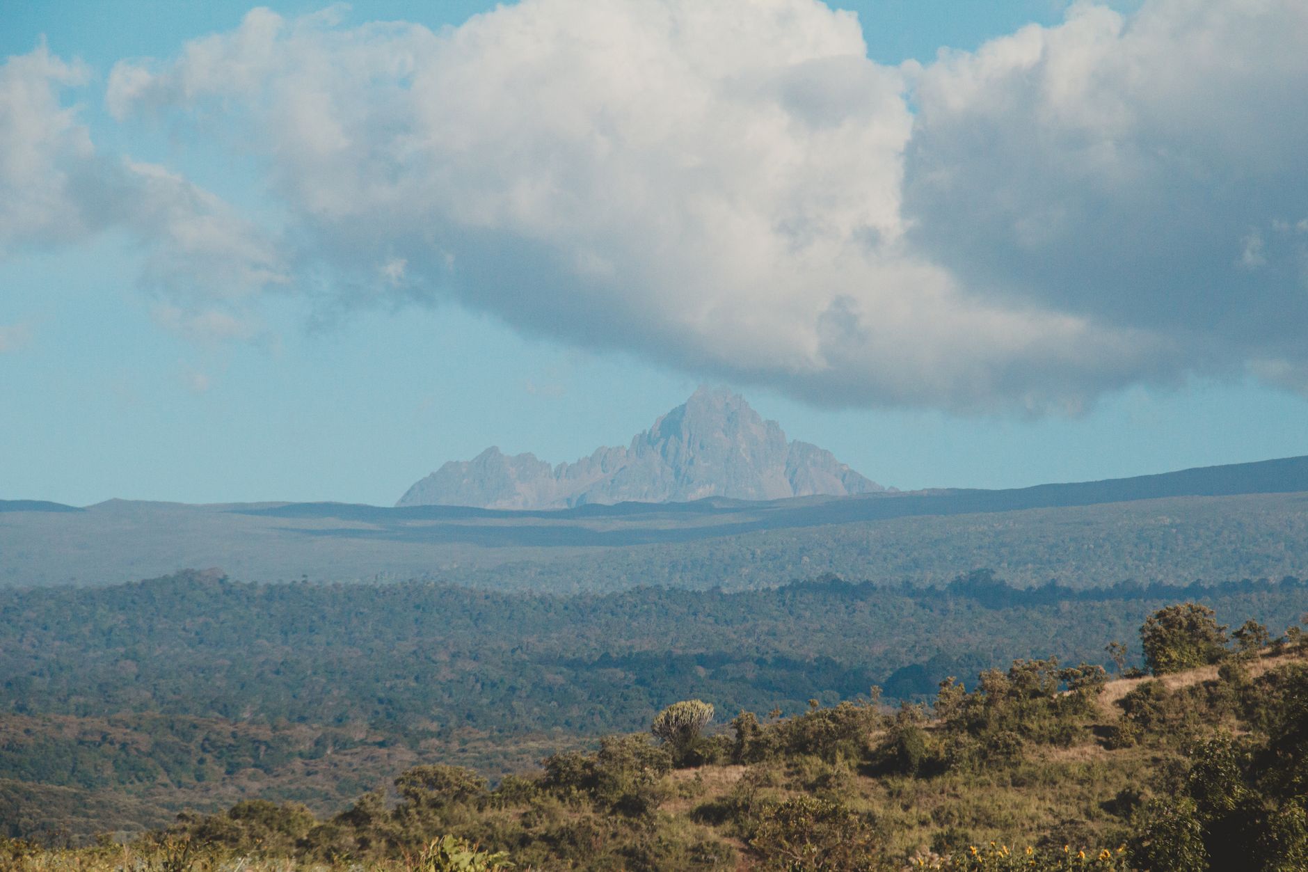
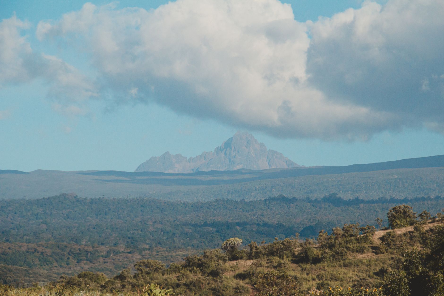
Yes, on a clear day Mount Kenya rises majestically behind the equator marker, making a spectacular backdrop for photos. Mornings are best, before cloud builds over the peaks. The combination of the equator sign and the mountain behind it is one of the most photogenic scenes in the Nanyuki area.
Is the Nanyuki equator worth visiting?
Yes — it’s quick, free to stand at, fun, and a quintessential Nanyuki experience that almost every visitor enjoys. The entertaining water demonstration, the photo astride the line, the curio stalls and the Mount Kenya backdrop make it a delightful twenty-minute stop, easily combined with other excursions or done en route.
Can children visit the equator demonstration?
Absolutely — it’s a highlight for kids and a brilliant hands-on geography lesson. Standing in two hemispheres at once, watching the water swirl, and earning a crossing certificate delights children, and the guides are good with young visitors. The quick, interactive stop suits short attention spans perfectly.
Are there facilities at the Nanyuki equator?
There are curio stalls and craft sellers, guides who perform the demonstration and issue certificates, and space to park. It’s a roadside stop rather than a developed attraction, so facilities are basic, but the town centre with its cafes, shops and restrooms is only a few kilometres away.
Where is the equator in Nanyuki?
On the main Nanyuki–Nairobi highway, just a few kilometres from the centre of town, marked by a large yellow signboard reading “This sign is on the Equator.” It’s directly on the route into and out of Laikipia, with space to pull over — an easy, unmissable stop.
What is the equator water demonstration?
Local guides pour water into a basin on the equator line and a few metres either side, showing it swirl clockwise north of the line, anticlockwise south, and barely at all on it. It’s presented as the Coriolis effect — entertaining and memorable, though at this small scale the swirl is actually created by the guide’s technique rather than the planet’s rotation.
Is the equator demonstration real science?
The Coriolis effect is real and shapes weather and ocean currents, but it’s far too weak to control which way a small basin of water drains — the swirl you see is created by how the guide pours and tilts. It’s a fun, memorable demonstration of a genuine concept rather than a strict scientific proof.
How much does it cost to visit the Nanyuki equator?
There’s no formal entry fee to stand at the marker. It’s customary to tip the guide who performs the demonstration (a small note), and the souvenir certificate carries a small negotiable fee. Curios at the stalls are extra and open to bargaining.
How long should I spend at the equator?
About twenty minutes is plenty for the demonstration, photos and a browse of the stalls. Because it’s quick, combine it with other Nanyuki experiences — a conservancy visit, Mount Kenya, or Ngare Ndare Forest — rather than treating it as a standalone destination. See our day trips guide.
The equator is a quintessential Nanyuki stop. Combine it with our guides to day trips, the town’s history, and the complete Nanyuki town guide.